

UN warns of 'supersized' El Niño as countries prepare for impact
The WMO has warned that the natural weather phenomenon could bring disruption to global economies.
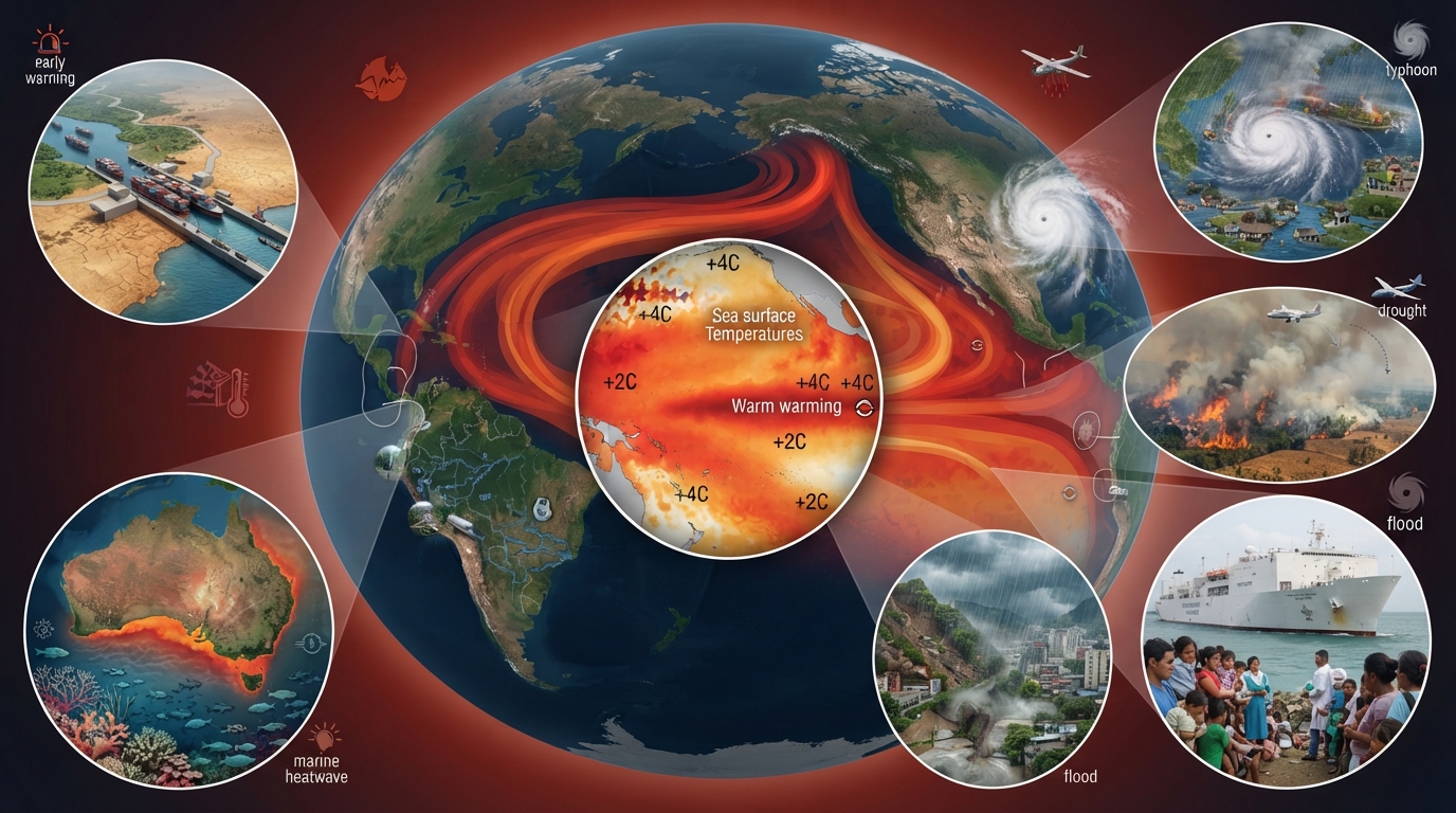
The United Nations has issued a warning about a "supersized" El Niño, as nations worldwide brace for its effects. UN head António Guterres stated that the world has entered a "danger zone of extreme weather" as El Niño's global impacts begin to manifest.
The World Meteorological Organization (WMO) has released updated data on this natural weather phenomenon, indicating it could be the most powerful in over 70 years and persist until at least February 2027. El Niño alters global weather patterns, leading to droughts in some areas while others experience more intense typhoons and floods. Forecasters also predict that El Niño will elevate temperatures in certain locations, compounding the global heat increase already driven by human-induced climate change.
Guterres remarked, "El Niño is being supersized before our eyes. The science leaves no room for doubt: the planet is in uncharted waters, and those waters are heating up."
The BBC engaged with governments and scientists to discuss global measures being implemented to mitigate the risks of fatalities, displacement, and environmental damage. Early warning systems have been enhanced, and pre-emptive medical assistance is being deployed. However, the intensity of this particular event has raised significant concerns, especially for vulnerable populations.
The WMO, a UN agency, announced a "major mobilisation" to disseminate its forecasts of potential extreme weather events linked to El Niño to as many communities as possible. WMO Secretary-General Celeste Saulo cautioned, "El Niño has the potential to deliver a massive blow to communities and economies across the world."
El Niño is a natural weather phenomenon originating in the Pacific Ocean, associated with shifts in wind patterns. It facilitates the eastward spread of warm water and releases heat into the atmosphere. Sea temperatures in the central and eastern tropical Pacific have sharply increased in recent months, signaling a strengthening El Niño. In the Pacific's primary monitoring region, surface temperatures have been consistently more than 2C above average in recent weeks, indicating it is on track to be classified as a "very strong" event.
However, it is anticipated to exceed even that threshold. Forecasts suggest that monthly sea surface temperatures could approach 4C above average, potentially making it the strongest El Niño since at least 1950, possibly by a significant margin. Temperatures are even more exceptional beneath the Pacific's surface, exceeding 8C above average in some areas. Above-normal sea temperatures are also expected in other parts of the world, including the Indian Ocean, tropical Atlantic, and around sections of the Australian coast.
Australia, with its rich marine life, is particularly concerned about changes in ocean heat. The country has experienced marine heatwaves in recent years, driven by climate change. Dr. Alistair Hobday, chief researcher at Australia's science agency, informed the BBC that while El Niño is a natural phenomenon, it tends to bring the kind of extreme heat that also fuels these disasters. This year, marine heatwave forecasts suggest the Great Barrier Reef will be spared the worst conditions, allowing its coral more time to recover. "[But] Southern Australia is getting slammed," Hobday stated. The last marine heatwave to impact South Australia and Tasmania led to starving penguins, fish kills, suffocating algae outbreaks, and jellyfish invasions. Australia has recently implemented early warning systems for marine crises, providing time for financial relief for fisheries, relocation of crucial species, and increased coral monitoring. However, this event is shaping up to be unprecedented, and Hobday admitted he is quite worried.
While El Niño's global weather impacts are likely to extend well into 2027, the WMO anticipates significant changes in rainfall patterns over the next few months. Drier-than-usual conditions are predicted across large areas of Southeast Asia, Central America, and northern parts of South America, heightening the risk of droughts and wildfires. On Thursday, the number of vessels transiting the Panama Canal will be reduced by over 10% in anticipation of lower rainfall. Approximately 14,000 ships annually use this artificial waterway, which is both a crucial route for global trade and a key source of income for Panama, generating about $3 billion (£2.2 billion) per year.
Indonesia is actively working to control wildfires that have consumed over 107,000 hectares of land nationwide during this dry season. Like some other parts of Southeast Asia, it is facing a longer dry season this year. A resident in Central Kalimantan told BBC News Indonesia that he had been experiencing wildfires "for more than a month." Darwin Romy described, "The smoke has become quite thick. When we step outside, our eyes start to sting. The smell of the smoke is also quite strong." Authorities have stated they are deploying cloud-seeding aircraft to induce rain to extinguish these fires, and the government has pledged resources to contain the fires and arrested dozens on allegations of using fire to clear land.
Thousands of miles away, China expects seven typhoons to make landfall this year alone, a phenomenon the country's experts link to the effects of a super El Niño. In July alone, China experienced three typhoons—Bavi, Noul, and Maysak—which resulted in dozens of fatalities. In August, over 1 million people were forced to evacuate their homes as Typhoon Dolphin struck, bringing heavy rains and strong winds. Similarly, wetter-than-average weather is anticipated in parts of eastern Africa, southern Brazil, and the southern US, increasing the likelihood of flooding.
"We are already seeing disruption and devastation from droughts and floods and we expect these impacts to increase as El Niño intensifies," said Prof. Celeste Saulo, secretary general of the WMO. This is occurring in addition to long-term human-caused warming, potentially making the impacts more severe. Some scientists believe climate change could even be intensifying El Niño events, though this is not yet confirmed.
Peru is particularly susceptible to El Niño, as its coastline borders the eastern Pacific. Parts of the country, along with Ecuador and sections of Brazil, have previously experienced increased rainfall, leading to flash flooding and landslides, especially in urban centers where water drainage is less efficient. Miguel Aréstegui, climate resilience lead at Practical Action, an organization that assists countries in preparing for extreme weather, stated, "we are significantly concerned, but that concern needs to translate into preparedness rather than alarm." He noted that Practical Action has been collaborating with partners in recent years to ensure the public has better access to early warning systems, including sharing information on river levels, flood risks, and weather forecasts. At the end of last month, the US announced the deployment of the vessel USNS Comfort to the Peruvian coast to provide additional medical assistance and technical equipment for when El Niño reaches its peak. However, Aréstegui emphasized that El Niño "does not arrive in a vacuum." He explained that larger, structural issues exacerbate these events and take much longer to resolve, such as "housing in exposed areas, fragile water and sanitation systems, and a weak healthcare system."