

Typhoons batter East Asia as El Niño makes Pacific 'burn with fever'
Even for countries where typhoons are a way of life, the last few months have brought unusually wild weather.
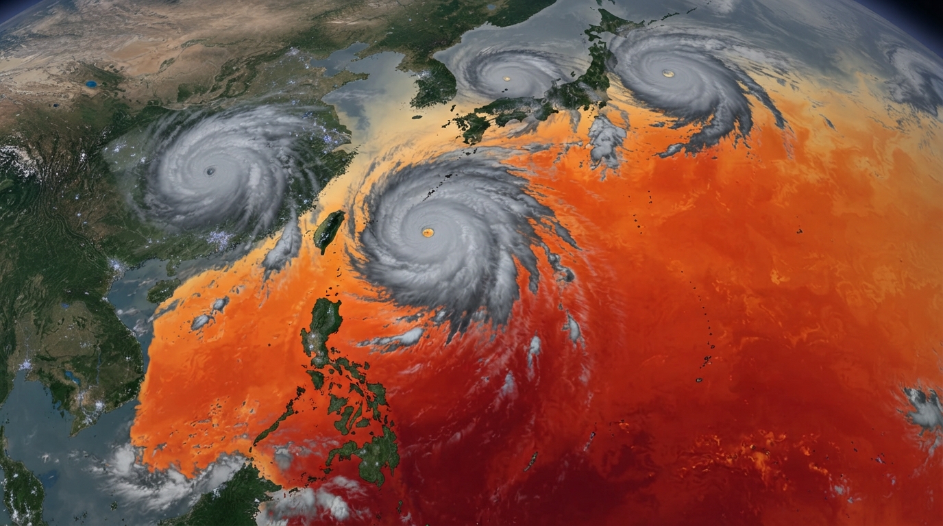
**Typhoons batter East Asia as El Niño makes Pacific 'burn with fever'**
Wild weather is nothing new for people living along the coasts of the Philippines, Taiwan, China and Japan. But the past few months have been exceptional.
A run of severe and, at times, erratic storms intensified by the El Niño weather pattern has killed dozens, closed major airports and destroyed crops and infrastructure across much of East Asia.
In October, almost all of Taiwan shut down as a huge storm, large enough to cover the island of 23 million, approached its north-eastern coast. With winds of 295km/h (193mph), equivalent to a category five hurricane, Typhoon Champi had the force to flatten houses and generate destructive waves.
Fortunately, it did not come ashore in Taiwan, passing by the island while bringing heavy rain. But its effects were widespread: hundreds of flights were cancelled in Hong Kong, Taiwan and Japan. In the Philippines' Batanes archipelago, coastal highways were closed as massive waves hit the shore, and in southern Japan's Okinawa islands, 15,000 homes lost power.
El Niño is a naturally occurring climate phenomenon in which warm water gathering in the eastern Pacific and shifting wind patterns trigger extreme weather events around the world.
It occurs roughly every two to seven years and lasts for about a year. This year's El Niño, which the UK Met Office has predicted will be the "strongest in living memory", is expected to continue until February or March.
In June, Japan saw two storms - Typhoon Mekkhala and Severe Tropical Storm Higos - move toward its eastern coast at the same time, prompting one million people to evacuate. In July, Tropical Storm Narra brushed China's southern coast in Guangxi, flooding villages and forcing tens of thousands from their homes.
August brought Super Typhoon Dolphin, which travelled across the Pacific for 16 days before striking eastern China, causing severe flooding and dozens of deaths.
Later that month, Typhoon Saudel made landfall in three south-eastern Chinese cities over the course of a week, disrupting transport systems and forcing thousands to evacuate.
The Pacific Ocean, heated to record levels by El Niño, is now full of typhoon energy, according to the Accumulated Cyclone Energy (ACE) measure, which tracks the total strength of a season's storms. This year, the ACE reading for South East and East Asia is expected to be almost twice the 30-year average.
El Niño also changes wind patterns and, in this case, that means typhoons are tending to form farther east than normal. They are also growing stronger because they stay over warm water for longer.
The Pacific can be compared to someone "burning with fever", says Ana Liza Solis, head of climatology at the Philippines' national weather bureau. "It can go into convulsions soon," she said at a press briefing in Manila in September.
Forecasts indicate the worst may not be over. Last month, sea surface temperatures in the equatorial Pacific - the region monitored by the Japan Meteorological Agency for its El Niño forecasts - climbed to 4C above normal, the highest level since records began in 1949. The previous record - 3.6C - was set in December 1997.
China's climate agency has warned that sea surface temperatures will continue rising over the next three months because of El Niño.
Although typhoon season usually peaks around September to October, this is likely to heighten concern across a region that has already been hit by storm after storm.
In August, Typhoon Chan-Hom puzzled storm watchers in Japan by moving across the country from east to west, rather than following the usual south-to-north path. Japan's well-equipped and prepared authorities were able to evacuate people quickly, but that would be much harder in some neighbouring countries.
To better understand how rising temperatures could increase the danger, Manila-based climatologist Rafaela Jane Delfino and colleagues modelled the effects of warmer conditions on the Philippines' most recent monster storms, including 2013's Super Typhoon Haiyan (Yolanda), which killed more than 6,000 people.
They reached what she calls "very, very scary findings": higher temperatures raised total accumulated rainfall by 26%. That is a devastating outlook in a country where flooding from monsoon rains and about 20 tropical storms a year has become one of the main disaster risks.
In recent years, floods have brought entire cities to a standstill for days, and weary of the yearly ordeal, Filipinos have taken to the streets to protest corruption, which they say is eating away at millions of dollars from flood-control projects.
Delfino, in an article on the University of the Philippines website, says leaders and officials must better understand climate hazards if communities are to be better prepared.
Countries are preparing for the immediate effects. Japan has told citizens to stockpile food and essentials for typhoon season, and to secure outdoor furniture that could become deadly projectiles when typhoon winds strike. China has asked local officials to identify vulnerable areas and is improving its warning and monitoring systems.
The Philippines and its South East Asian neighbours are getting ready for disruptions to food production, especially rice, and have stepped up support for farmers, including supplying fertilisers.
But the longer-term picture is less certain. The window for governments to act on El Niño is "closing", the United Nations Development Programme in Asia and the Pacific said recently.
"How severely a community experiences an El Niño is decided years in advance, by where roads and settlements are built, how water is managed, who is covered by social protection and whether public budgets have room to absorb a shock.
"Every El Niño tests the resilience we have built; this one should also drive us to build more," it added.