

The new satellite launched into orbit has sent its first images of the Earth
Just two weeks after its launch, Europe's Copernicus Sentinel-3C satellite sent its first images and measurement data of the Earth. The initial images feature Italy, the Canadian Arctic, and the Caribbean.
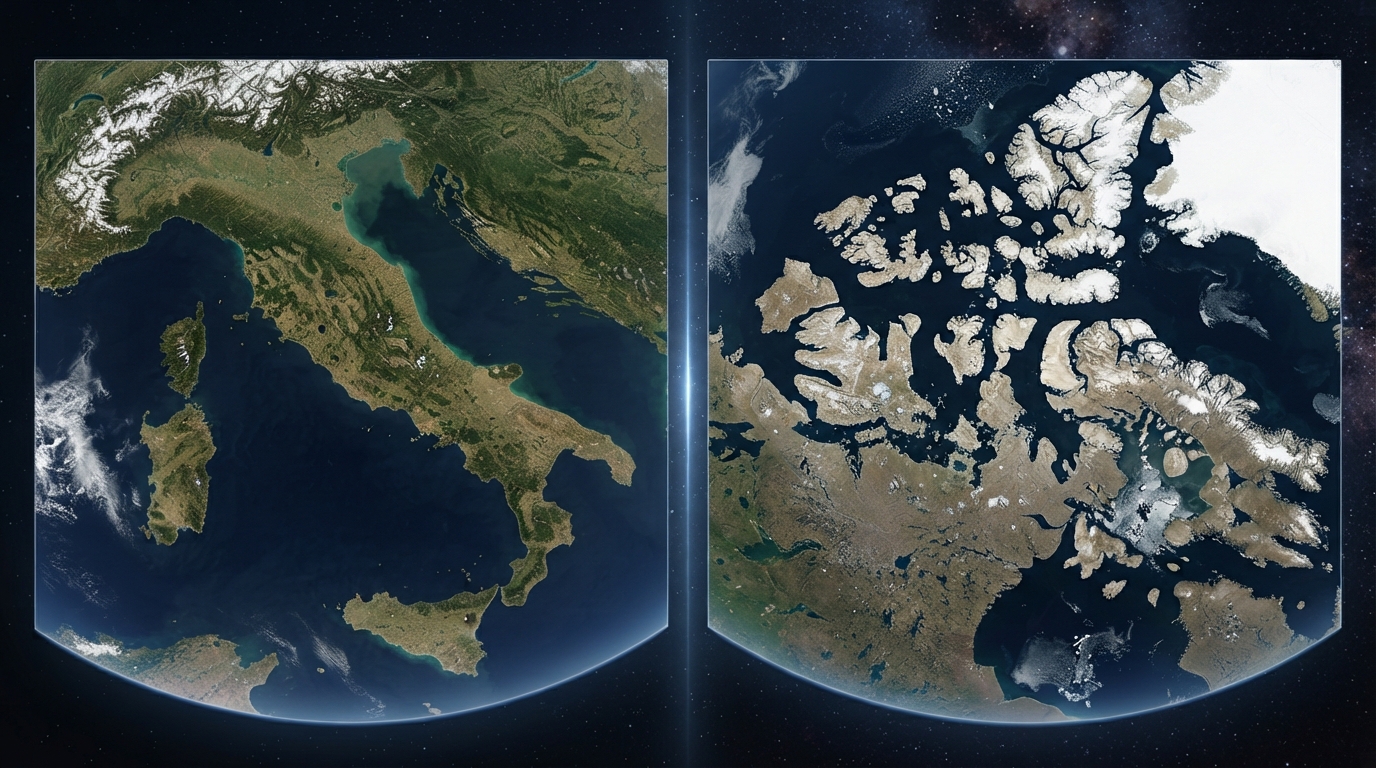
Newly launched satellite transmits first images of Earth
According to information provided by the European Space Agency (ESA), the images and measurements were obtained using two main instruments on the device. The results confirmed their functionality, but it will take about five more months to fully prepare the satellite for operation.
Sentinel-3C is the third spacecraft in the Sentinel-3 series. It will continue to collect long-term environmental data on the state of the oceans, land, glaciers, and atmosphere.
The first image shows Italy in natural colors. The frame covers an area from the southern regions of Germany to Sicily and the southern part of the Mediterranean Sea.
Slightly above the center of the image, the Po River Valley—an important agricultural region of Italy—is visible. Its green and brown fields contrast sharply with the snowy Alpine peaks to the north.
To the east, the Adriatic Sea separates the Apennine Peninsula from the Balkans. The lighter blue shade of the water along Italy's eastern coast is likely due to sediment carried into the sea by rivers.
To the west, the dark waters of the Tyrrhenian Sea, as well as the islands of Sardinia and Sicily, are visible. A large part of Corsica remains covered by clouds.
The second image demonstrates part of the Canadian Arctic Archipelago to the west of Greenland. Snow- and ice-covered islands, deep fjords, and exposed rocks create a complex natural landscape.
Fragments of broken ice are also visible on the dark surface of the open water. Monitoring the state of ice and water in the Arctic is crucial for understanding the changes occurring in the polar regions.