

El Niño is strengthening: What is expected for October and the next 2 months in Uzbekistan? Gazeta forecast
In October, although warm and cool days are expected to alternate across Uzbekistan, temperatures will remain around normal, but precipitation is expected to be above normal due to humid air currents. The strong El Niño phenomenon in the Pacific Ocean may ensure that autumn and the beginning of winter are wet and relatively warm.
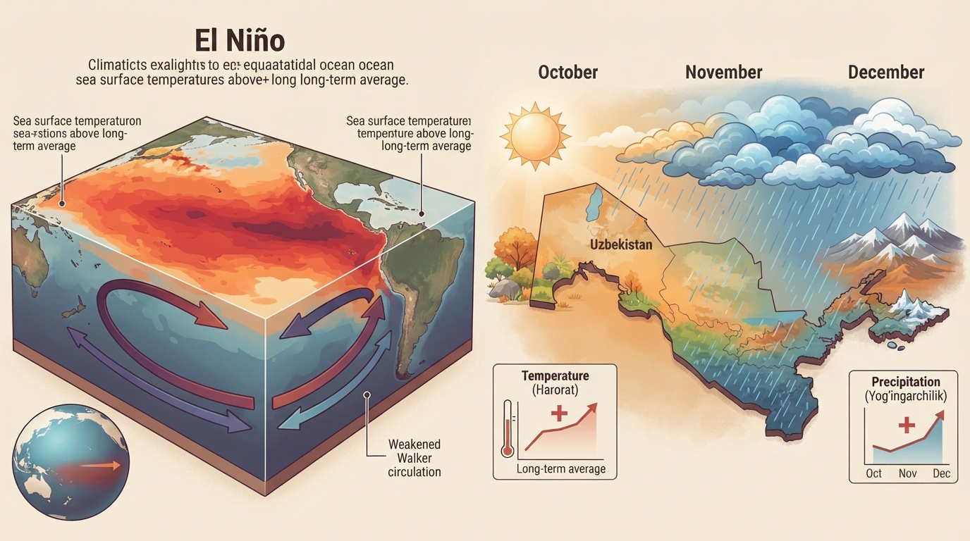
El Niño is strengthening: What is expected in Uzbekistan in October and the following 2 months? Gazeta forecast
In the equatorial region of the Pacific Ocean, El Niño, i.e., the sharp warming of water, is strengthening at a rapid pace. In the final days of September, the average water temperature in the central large part of the Pacific Ocean rose more than 3 degrees above the long-term climatological norm. This indicator perfectly matches the classification of a very strong El Niño. Over the last 150 years, water temperatures in this exact part of the ocean have not warmed this early and to such a high level as this year.
According to the assessment of the World Meteorological Organization, the probability of El Niño turning into a very strong event in the autumn and winter of 2026 is equal to 100 percent. Since such a process has not been observed for many years, it can be called a super El Niño.
According to the global seasonal forecast of the World Meteorological Organization published on September 3, further activation of the strong El Niño, temperatures significantly above normal in a large part of the world, and the formation of a positive dipole in the Indian Ocean are expected in September-November.
"A strong El Niño is considered one of the major climatic factors influencing the probability of precipitation and temperature regime deviations from the norm in Uzbekistan.
Detailed information about this is left in the dissertation work on the topic "Assessment of the potential impact of El Niño and La Niña processes on the weather of Uzbekistan."
The researcher notes that very strong El Niños observed in the world since 1963 may have made the autumn-winter-spring seasons in Uzbekistan relatively warmer and wetter. According to the study, in years when a very strong El Niño was observed, precipitation was above normal at more than 80 percent of the 50 meteorological stations in Uzbekistan. In winter, temperatures were recorded higher than the appropriate norms for the region by +1.8…+3.5°C in Termez, +2…+4.5°C in Tashkent, and +1…+2.5°C in Andijan.
The strongest anomalies were mainly observed in January-February. Very strong episodes are shown: in 1982–1983, the winter temperature anomaly in Nukus reached up to +3.3…+4.9°C, in 1997–1998 it was +2.0…+3.5°C, in 2015–2016 it was +1.5…+2.5°C, and in 2023–2024 it was mainly around +1…+2°C in autumn-winter.
The World Meteorological Organization also usually provides long-term forecasts based on the warming and cooling phenomena of water temperatures in the central Pacific Ocean. Below, the forecast of the World Meteorological Organization shows that in September, October, and November of 2026, the seasonal temperature in Uzbekistan will be significantly higher than the long-term climatological norm, and in terms of precipitation, seasonal rainfall will fall above the norm.
Based on various international weather centers, weather bureaus of neighboring countries, and other indicators, we present maps of deviations of monthly air temperature and precipitation from the long-term norm in Uzbekistan for October-November and the first month of winter, December.
October is a month in Uzbekistan when the transition from summer to autumn is clearly felt. The temperature is up to 6–9 degrees lower compared to September: during the day it is usually observed in the range of +10…+28°C, and at night +2…+17°C. In the second half of the month, the first autumn frosts may be observed. Precipitation increases compared to September, with rain falling 4–6 days a month in most regions. However, October weather is variable: some years it is very wet, and some years it is very dry. For example, October of 2020 and 2025 was very dry.
In the advisory weather forecast provided for October, Uzhydromet gave information on how this month's temperature and precipitation may deviate relative to the long-term monthly norm. It is understood that across the republic in October, in the regions where the main agricultural crop areas are located, the average monthly air temperature may be from +10 degrees to +19 degrees, and in terms of precipitation, from 4 mm to 24 mm of rain may fall in the republic during the month.
Thus, it is stated that in a large part of the republic, October will be close to the long-term norm or wet in terms of precipitation, while in the Khorezm region and Karakalpakstan, precipitation will fall below the norm. On the forecast map, the average monthly precipitation values for each region are given in the form of numbers. Based on such values, observers can estimate how much precipitation may fall in the regions.
During the month, there is a high probability of precipitation from three or four, and in some regions up to five or six wet air currents in many areas. In mountains and even in settlements close to the foothills, snow may fall in the second half of the month. This means we will witness a lot of precipitation during the month.
The World Meteorological Organization also stated that monthly precipitation for the region in October could be significantly above normal.
In terms of temperature, it became clear that during the month, the average monthly temperature will be around the norm, with slightly above-normal temperatures observed only in a large part of the Surxondaryo and Qashqadaryo regions, and in the territories of the Bukhara region.
On October 2–4, precipitation is not expected in a large part of the republic's territory, and temperatures will rise. From October 4, cold air will enter the northwestern regions and spread across the republic on October 5–7.
During the month, warm and cool periods will alternate frequently. On warm days, the temperature will rise up to +10…+13°C at night and +25…+28°C during the day. When cold air enters, it will drop to +3…+8°C at night and +15…+20°C during the day. In the north, the temperature may be 0…-2°C at night and +10…+15°C during the day.
When compiling forecasts for November and December, one should not limit themselves only to the El Niño phenomenon but also pay attention to other indicators. For example, atmospheric circulation in the Atlantic, which brings precipitation, is also very important. This indicator is currently in a position that brings moisture to our region. Its influence will ensure the entry of several wet air currents into Uzbekistan until mid-October.
Another factor determining the precipitation capacity in the region during the winter-spring season is the warming or cooling of water in the northern Indian Ocean, with which the Indian Ocean Dipole is in a positive phase. In the coming three months, i.e., in autumn and the beginning of winter, it will change towards strong warming and will probably remain one of the additional climatic factors that can influence the main regional atmospheric circulation in the strong formation of moisture for our region.
There are currently no expectations regarding an anomalously sharp cooling of air temperature in October. However, the entry of cold currents from the north in November and December, even if short-term, is not ruled out.
Uzhydromet has not provided an advisory forecast for November and December. However, the Afghanistan Meteorological Department, which has recently been working quite progressively in the field of weather forecasting in the region, has posted on its official page a forecast on how the general 3-month seasonal temperature and seasonal precipitation for October, November, and December may deviate from the norm. According to it, in the coming 3 months, seasonal precipitation in a large part of Afghanistan is shown to fall above normal, and the seasonal temperature will also be slightly above normal, i.e., warm.
The Afghan forecast can be used as a proxy indicator for Surxondaryo, but it cannot be interpreted as a forecast for Surxondaryo.
In November, too, precipitation in a large part of the republic is predicted to be above the long-term climatological norm, i.e., wet, and in terms of temperature, the monthly temperature will be around and above the long-term norm. For the month, there is a high probability of earlier entry of cold air currents coming from the north and sudden occurrences of the first snowfall even in densely populated cities. Such a situation does not mean that the month will be cold. On the contrary, in November, like in October, warm days will be more frequent and prolonged. In this month, too, while normal precipitation is expected in the territories of the Republic of Karakalpakstan, it is becoming clear that significantly more precipitation than normal will occur in the territories of Surxondaryo, Qashqadaryo, Jizzakh, Sirdaryo, and Tashkent regions.
It is mentioned that in the region, December, like November, will pass against the background of slightly higher temperatures in the temperature regime, and in terms of precipitation, there will be more precipitation than normal in many areas. In December, there is a high probability of more southern cyclones emerging from the south. That is, except for the northern territories, high wetness is expected to be characteristic of all regions of the republic.
Even if it is a repetition, it is worth emphasizing once again that the accuracy rate of long-term, particularly monthly and seasonal weather forecasts, is quite low. Methods that can provide forecasts with an accuracy higher than 60–70 percent for each month in the autumn-winter season do not yet exist.