

Curiosity, which has been working on Mars for 14 years, showed new landscapes
NASA's Curiosity rover has reached two more milestones during its operation on Mars. The device has spent 5,000 Martian days on the Red Planet and ascended to a height of one kilometer above its landing point. New images show the path it has traveled along Mount Sharp, while the mission's October report is dedicated to the analysis of another rock sample.
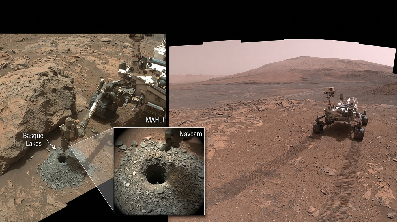
Curiosity, operating on Mars for 14 years, revealed new landscapes
Curiosity, which landed on Mars on August 6, 2012, continues its research into the 15th year of its activity on the planet's surface. In the summer of 2026, 14 years have passed since the rover's arrival on Mars. During this period, it has been examining rock formations and photographing layers to study the planet's ancient environmental conditions.
In the autumn, NASA presented images of the next segment of the rover's route, as well as a report on a sample taken from a drill hole named Basque Lakes. The mission team's October 5 update described the process of analyzing this material in the onboard laboratories.
Specialists were wrapping up examinations with the CheMin instrument and preparing for subsequent work with the SAM analytical suite. Measurements from the laser spectrometer were to determine whether additional mass-spectrometric analysis of the sample was necessary.
Drilling and laboratory work require a significant portion of the rover's daily energy supply. For this reason, the use of other instruments is restricted during such times. Nevertheless, the team planned to capture a full-coverage mosaic using Mastcam cameras to study the geological environment surrounding the drilling site.
The cameras also conducted observations under different positions of the Sun in the sky. As the lighting changes, the appearance of the rocks in the images changes as well. Therefore, such observations help to interpret their color and spectral characteristics more accurately.
A navigation camera image taken on September 24, on the mission's 5,024th Martian day, shows the Basque Lakes drill hole and the crushed material around it. Such images document where the sample was obtained, making it possible to correlate laboratory results with the geological context of that specific location.
A large summer panorama was released on August 26 to mark the rover's elevation gain of one kilometer relative to its landing point. The image was assembled from 323 frames taken by Mastcam cameras on August 1 and 2 — the mission's 4,972nd and 4,973rd Martian days.
The panorama captures a view opening up from the wide Valle Grande valley toward the lower slopes of Mount Sharp and the floor of Gale Crater. In an enlarged section of the image, the long tracks left by the rover's wheels can be seen stretching far into the distance. The crater floor and its northern rim are also visible through the dusty atmosphere.