

Satellite images reveal scale of flood devastation in Nepal villages
Before-and-after images show villages, bridges and a key Nepal-Tibet border crossing washed away by devastating floodwaters.
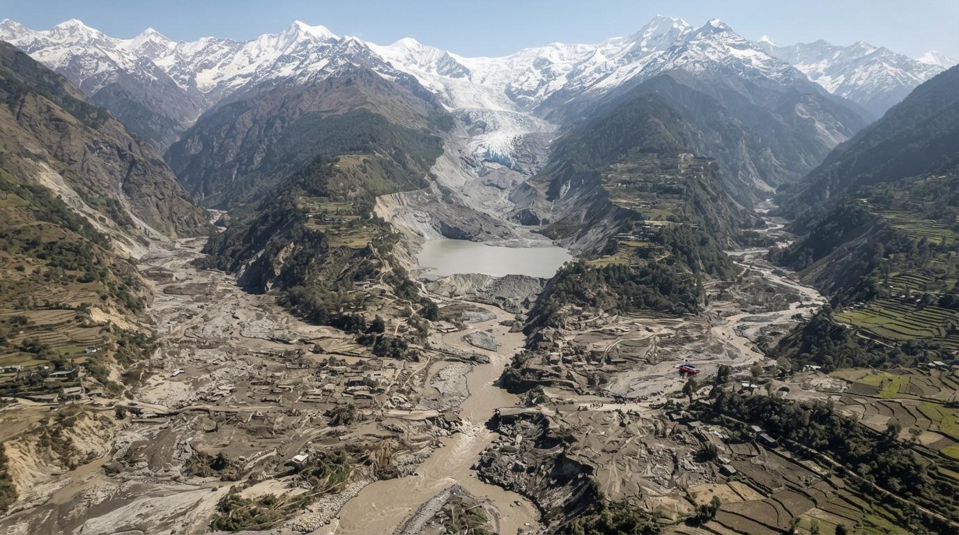
Satellite imagery has brought to light the extensive destruction inflicted upon Nepalese communities by Wednesday's deadly flash flood, which originated from a glacier collapse and surged along the Trishuli River.
Before-and-after comparisons reveal how the powerful rush of floodwater and debris obliterated villages, bridges, and hydroelectric power stations within the valley. Nepalese officials report over 550 fatalities, with hundreds more unaccounted for.
Among the severely impacted areas examined by BBC Verify was a crucial Nepal-Tibet border crossing, which was overwhelmed by the floodwaters and captured on video. Satellite images from the US-based intelligence firm Vantor indicate that the site has been almost entirely swept away. Dramatic CCTV footage depicted the moment the deluge engulfed buildings as people desperately tried to escape.
Evidence of damage and mud extends over 2.5 kilometers (1.5 miles) upstream, reaching 100 meters (330 feet) above the initial impact zone. A few miles further south, the village of Timure has largely vanished. The steep valley walls, rising up to 50 meters above the waterline, show that most houses previously situated on the slope are now gone or buried in mud.
Another 10 kilometers (eight miles) downstream, where the Trishuli River meanders through Syapru Besi, satellite imagery now shows the village submerged under mud, rock, and other debris. Houses and other structures, including bridges and a hydroelectric power station, have disappeared.
The village of Trishuli, one of the larger settlements hit by the full force of the flood, was also where some of the earliest verified footage of the disaster emerged. A satellite image of the town and its surrounding agricultural land, located approximately 45 kilometers (28 miles) downstream from the border, shows an entire neighborhood has been essentially wiped out.
Verified videos from Trishuli show a bridge collapsing as the river surged. Simultaneously, ground-level footage from inside a bus captured people crying out in distress and attempting to flee as they witnessed the water rushing down the river. Other dramatic videos show individuals sheltering inside a house, peering from a balcony as a torrent of floodwater swept away nearly everything around them, including large metal debris and a vehicle, towards the building. Remarkably, the house remained intact, and survivors were seen in a second verified video standing amidst mud after the floodwaters receded.
Imagery released today by satellite provider Planet Labs has also offered a clearer perspective on the disaster's origin at the collapsed glacier, a moment captured in a verified drone video. The satellite image reveals an enormous section of the glacier has broken off, carving a massive path of rock and debris through which water surged down the valley. At the base of the landslide, trees and other vegetation have been stripped away to a height of over 300 meters above the riverbed. This destructive path continues westward along the swollen river before turning southward.
Satellite images also show the formation of a barrier lake at the base of the landslide's path. Chinese authorities have issued warnings that this lake poses a significant risk of further flooding and has hindered rescue operations. Dr. Argha Banerjee, a glaciologist at the Indian Institute of Science Education and Research, informed BBC Verify that the images do not allow for a determination of the barrier's stability or the likelihood of the lake suddenly draining. However, he noted that there was no significant increase in its surface area between Wednesday and Thursday, despite continuous water inflow. Dr. Banerjee also pointed out a visible drainage channel, suggesting some water was already flowing downstream, adding that the lake's volume was "not alarmingly large" and appeared to have stabilized.
The extent of the damage on the Tibetan side of the border remains unclear. This region, annexed by China in the 1950s, is strictly controlled, and foreign media access is heavily restricted. BBC Verify has so far been unable to find verifiable footage from the area.
The satellite imagery, which provides an initial glimpse into the flood's damage, has been published by Vantor as part of its Open Data Program. This initiative aims to assist authorities in identifying the most critical areas to focus their efforts on locating the missing, rescuing survivors, and recovering the deceased.