

Could the tragedy in Nepal be repeated in Sarez?
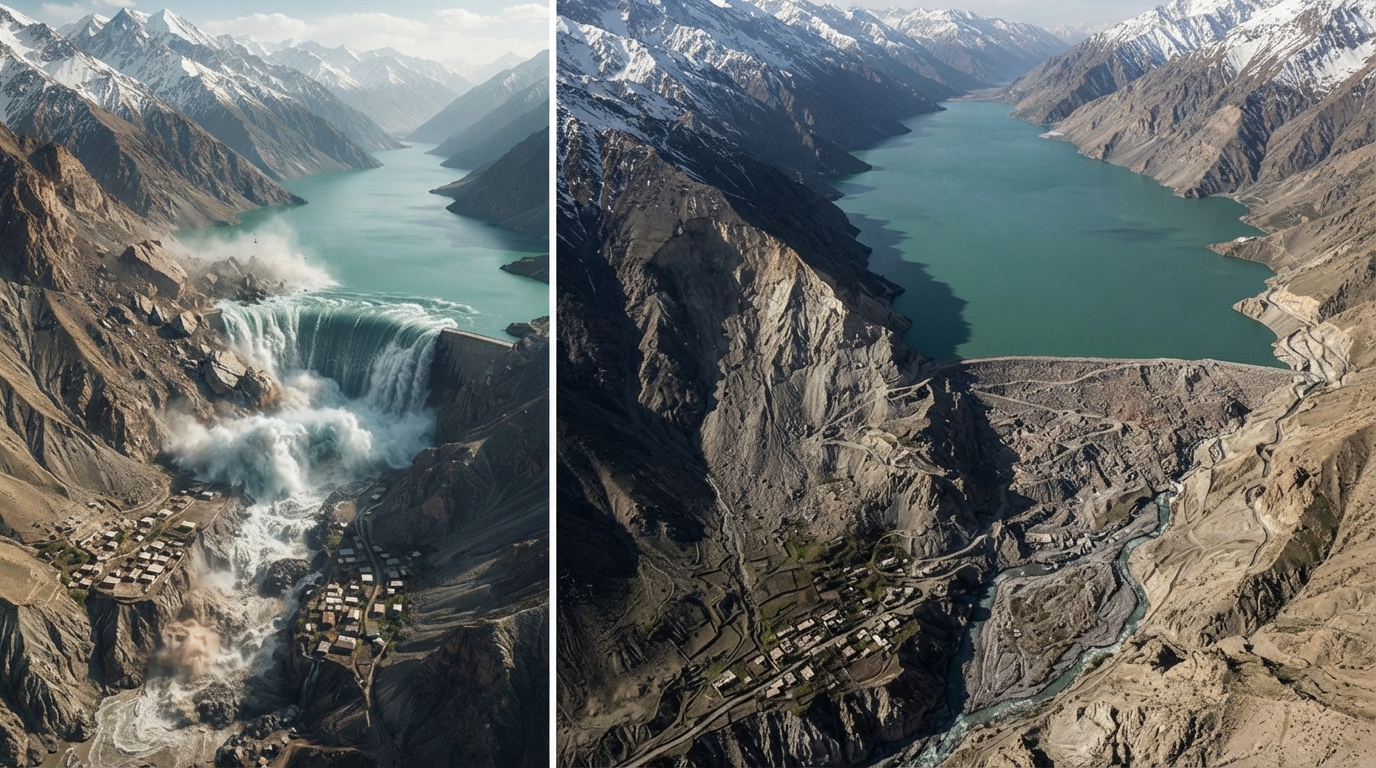
**Could the tragedy in Nepal be repeated in Sarez?**
On August 26, a natural disaster on the border of Nepal and Tibet shocked the entire world. A portion of a glacier collapsed, sending a massive volume of ice and rock into a river valley. As a result, the river was temporarily blocked, after which the newly formed natural barrier breached, unleashing a massive torrent of water, mud, and rock downstream.
As a result of the tragedy, more than 1,341 people lost their lives, and the number of missing persons rose sharply to 5,000. Although it was initially assumed that an earthquake caused the event, the US Geological Survey later reported that the recorded seismic tremor itself was triggered by the collapse of the glacier and rock mass.
The event in Nepal forces us to think once again about Lake Sarez in Central Asia, specifically in Tajikistan. This is because the situation in Nepal is very similar to the conditions at Sarez.
### How was Lake Sarez formed?
Sarez is no ordinary lake. Nor is it a man-made reservoir. This lake was created by nature itself, or more precisely, by a massive landslide. In 1911, a powerful earthquake occurred in the Pamir Mountains, in what is now the Gorno-Badakhshan Autonomous Region of Tajikistan.
As a result of the earthquake, a massive mountain collapsed, blocking the valley of the Murghab River. Thus, the Usoi Dam—a natural barrier reaching hundreds of meters in height—was formed, and over time, Lake Sarez took shape behind it.
Today, Lake Sarez is nearly 60 kilometers long, and its deepest point exceeds 500 meters. The lake contains approximately 16–18 cubic kilometers, or 16–18 billion cubic meters, of water.
A simple comparison is enough to visualize the scale of this figure. The total capacity of the Charvak reservoir in the Tashkent region is nearly 2 billion cubic meters. In other words, the volume of water accumulated in Lake Sarez is approximately 8–9 times greater than the maximum capacity of the Charvak reservoir.
### The main similarity between Nepal and Sarez
The process triggered in Nepal after a portion of a mountain slope collapsed into a water basin along with a glacier and rock mass also recalls concerns regarding Lake Sarez in Central Asia. In both cases, the primary danger is associated with a large volume of mountain mass collapsing into a water basin, displacing the water and generating a powerful flood wave.
In Nepal, as a result of the landslide falling into the water basin, a portion of the water rose above the basin and overtopped the dam or natural barrier. If such a process were to occur at Lake Sarez, the consequences could be even more severe. This is because the right bank of Lake Sarez is cited as one of the areas where there is a high probability of a large-scale rock landslide.
The essence of the danger here is that if the landslide itself falls into the lake, it could instantly displace a massive volume of water. As a result, a powerful wave could form on the lake's surface, potentially pushing the water toward the natural barrier—the Usoi Dam. In the worst-case scenario, the wave could overtop the dam, undermining its stability or causing a massive flood downstream.
Furthermore, the Pamir mountain range is a seismically active region where many earthquakes occur. On December 7, 2015, a powerful earthquake with a magnitude of 7.2 occurred in Tajikistan. Its epicenter was located approximately 105 kilometers away from Lake Sarez.
In an interview with "Daryo", geographer and hydrometeorologist Humoyun Maghripov explained the similarities and differences between the tragedy in Nepal and the situation around Lake Sarez, emphasizing that a direct comparison between these two events is inappropriate.
"The similarity between Lake Sarez and the tragedy in Nepal is that in both cases, a mountain valley was blocked as a result of a landslide. The differences, however, lie in the fact that the landslide in Sarez consisted entirely of rock. The landslide in Nepal, on the other hand, consisted of approximately 20–23 million cubic meters of ice. Ice melts, whereas rock is stable. The natural dam at Lake Sarez has stood for 115 years. The dam in Nepal, however, did not even last a day.
A displacement of rock of around 0.5–0.6 million cubic meters has been recorded on the right bank of Lake Sarez. However, comparing this to the landslide in Nepal is inappropriate. True, there is a possibility that this displacement will slide down at some point over time. But until then, we have the opportunity to take appropriate measures to prevent a disaster. At the very least, we can monitor how much it shifts per year by installing sensors.
Therefore, Sarez cannot be directly compared to Nepal. Precipitation around Sarez is very low. Since the amount of precipitation is low, the probability of a flood occurring in this area is also relatively low," he said.
### What happens if the Nepal scenario occurs at Sarez?
If a major landslide occurs around Lake Sarez, its consequences would primarily affect the territories of Tajikistan, as well as Afghanistan, Uzbekistan, and Turkmenistan. If the water in the lake overtops the dam as a result of a landslide, the water level could rise to a height of 100 meters in the area where the Bartang River flows into the Panj River.
Humoyun Maghripov also mentioned which areas could be at risk in the event of an emergency scenario related to Lake Sarez.
"First of all, may such a situation never occur. But if a landslide does happen, the village of Barchidiv, located close to the dam, will be the first to be at risk. Since the middle reaches of the mountainous areas are very steep, the water level may initially be high. The water height at the upper part of the dam has the potential to reach 50–100 meters. However, as the riverbed widens, the water level will decrease. The floodwaters, however, could reach the Aral Sea at a height of half a meter.
If a disaster occurs around Lake Sarez, its impact will not be limited to a single country. Such an event could affect the territories of Tajikistan, Turkmenistan, Uzbekistan, and Afghanistan.
In Uzbekistan, the Surxondaryo region would be the first to be at risk. The water might not reach the Qashqadaryo region, but it could damage the region's irrigation system through the Amu-Karshi canal, which draws water from the Amu Darya. Additionally, water could overflow into the areas of the Bukhara region adjacent to the Amu Darya. The greatest impact, however, is likely to be observed in the Khorezm region and the Republic of Karakalpakstan," the expert said.
### Studies around Sarez
Studying and monitoring the risks around Lake Sarez has become one of the key areas of focus for Tajikistan and its international partners in recent years. Work in this direction covers not only the lake itself but also the surrounding rock formations, upstream lakes, and potential landslide processes.
In particular, a monitoring and early warning system for Lake Sarez was launched in 2021. Within the framework of the project, implemented with the support of the Asian Development Bank, a system was installed to monitor the lake's water level and other hazard indicators, enabling rapid warning of the population in the event of an emergency. The system was reported to be actively operating as of 2023.
In addition, in September 2025, specialists from the Committee of Emergency Situations of Tajikistan, the Main Directorate of Geology, and the Central Asian Center for Ecology and Environment conducted a joint expedition to Lake Sarez and its upper reaches. During the study, aerial photographs were taken using drones, geological and bathymetric surveys were conducted, and the condition of natural dams in mountain lakes was assessed. The Center stated that such research will continue in the future.
Another important direction is monitoring the deformation of rock formations around Sarez using space technologies. In June 2025, specialists from Tajikistan and China discussed joint projects to monitor deformation processes in the Lake Sarez area using China's BeiDou satellite system.
At the same time, Sarez is being studied not only as a source of danger but also as a water resource for the region. In August 2024, a joint working group of Tajikistan and Uzbekistan on the integrated use of water resources discussed the possibility of using Lake Sarez's water to provide the region with clean drinking water in the future. For now, this is not an active project, but rather one of the prospects being studied and discussed.
Is monitoring the risks associated with Lake Sarez enough on its own? Is it possible to reduce the potential danger by controlling or lowering the lake's water level? According to Humoyun Maghripov, this issue is technically extremely complex, and for now, the main focus remains on observation and monitoring.
"Work on lowering and managing the water level of Lake Sarez is proving to be very complex. So far, almost no practical work has been carried out in this regard; it is mainly limited to observation. This is because even modern technologies are not sufficient to practically eliminate the problem associated with the lake. One of the main reasons for this is that Lake Sarez is located in an unfavorable area, at an altitude of 3,000–3,200 meters above sea level.
On the issue of Sarez, a single state cannot take measures independently. This is a common issue for the entire Central Asia. Even Afghanistan is involved in this process. If the countries of the region want to solve this problem, they must work together with their specialists under a single program, and if the necessary technologies are not available in the countries themselves, they must develop a solution in cooperation with countries that can provide them.
In fact, Tajikistan itself has approached the European Union with several initiatives on this matter. However, given the complexity of the situation, serious attention is not yet being paid to them.
However, there is no need to panic over this either. Lake Sarez is not a phenomenon that appeared five or six years ago. It has existed since 1911 and has withstood several natural processes during this time, including one of the powerful earthquakes," Humoyun Maghripov concluded.
### What did Nepal show us?
The biggest lesson to be learned from the tragedy in Nepal is that in mountainous areas, natural disasters can trigger one another in a short period, taking on a chain-like character. A single collapse of a glacier or rock mass can block a riverbed, forming a temporary natural dam, and its breach can cause a catastrophic flood downstream in just a few minutes. The fact that water levels in some areas of Nepal rose by 9 meters in just 30 minutes demonstrated how rapidly such processes can develop.
The situation regarding Lake Sarez must be studied seriously from this exact perspective. This is not a cause for panic, but a warning to be prepared in advance for potential danger. Early warning systems, continuous monitoring, a clear evacuation plan for the population, and the readiness of downstream infrastructure for an emergency are the most critical measures for areas with natural hazards like Sarez.
The Nepal tragedy showed once again that Sarez must be viewed in exactly this way: we must not wait for a disaster, but study its probability in advance and be prepared for it.