

A satellite that "sees" behind tree branches has taken new images of the Earth
The European Space Agency (ESA) has released the first images captured by the Biomass satellite during its first year. They cover tropical forests, Indonesian mangroves, the Yamal tundra, and Antarctic glaciers. The spacecraft's radar can penetrate dense foliage to collect data on the wooden parts of trees.
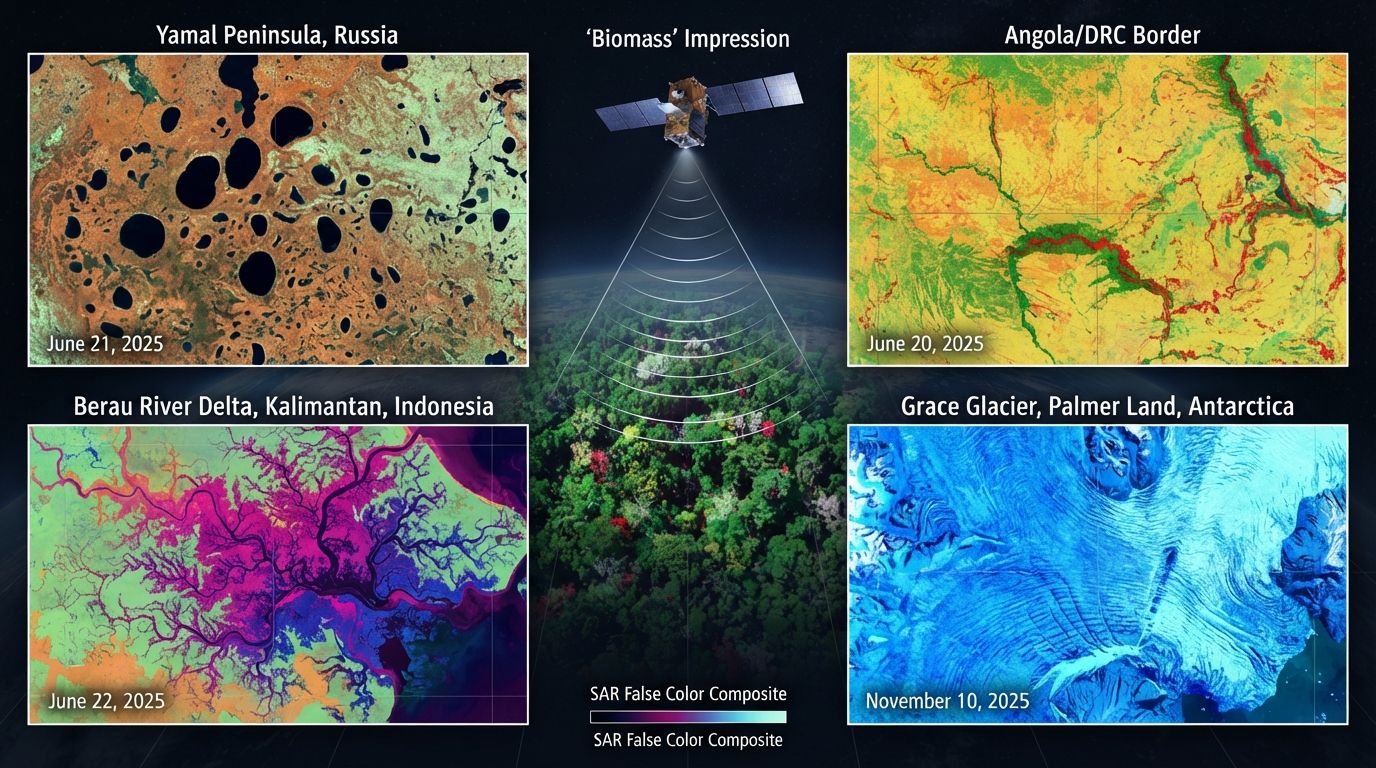
Satellite that "sees" behind tree canopies took new images of Earth
The set of images was presented on April 29, 2026 — on the occasion of the one-year anniversary of the satellite's launch
Biomass was primarily created to assess carbon stocks in forests. It is equipped with the first P-band synthetic aperture radar launched into orbit. Its signal passes through dense canopy to obtain information about tree trunks and large branches. Most of the forest carbon is stored precisely in the wood.
One of the images in the set shows the areas on the border of Angola and the Democratic Republic of the Congo. In the image taken on June 20, 2025, narrow forest corridors stretching along the river tributaries in the Congo, Kasai, and Kwango basins stand out. Savanna areas are located between them.
Another image taken on June 21 depicts a part of the Yamal Peninsula. Numerous rounded thermokarst lakes are visible against the tundra background.
In the Berau River delta in the Kalimantan region of Indonesia, the radar recorded branched channels among mangrove forests and swampy tropical vegetation. This image was taken on June 22.
The image of Antarctica dates back to November 10, 2025. It covers the Grace Glacier stream moving toward the sea in the western part of Palmer Land. Thin feather-like lines show crevasses in the ice. They occur due to internal stresses that arise when the glacier moves over an uneven bed and accelerates toward the coast.
The colors in the images are false. During data processing, distinct colors are assigned to various characteristics of the returned radar signal. This method helps to distinguish the structure of the land surface and vegetation. Therefore, green, blue, or pink areas do not represent the actual color of the terrain.