

UN voted to abandon the traditional world map
The UN General Assembly has adopted a resolution on transitioning to a map that more accurately reflects the size of continents, particularly Africa, on the world map. The document was supported by 164 countries, with only the US voting against.
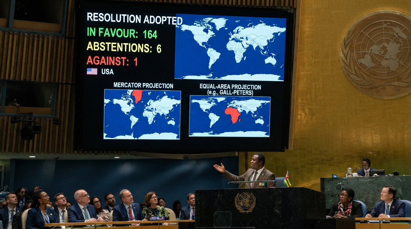
UN votes to abandon traditional world map
The UN General Assembly has approved a resolution to transition from the traditional map — the Mercator map — to a map that more accurately reflects the sizes of continents, primarily Africa.
The resolution was supported by 164 countries, while six abstained. Only the US opposed it, with its representative calling the document "superfluous."
One of the main proponents of the resolution was Togo. The country's representative noted that the resolution "recognizes and confirms that disproportionate cartographic representations, especially those resulting from the Mercator projection, have had long-term educational, cultural, geopolitical, and socio-economic consequences, contributing to a drastic reduction in the size of Africa and other regions of the world in the global collective consciousness."
According to The Guardian, UN resolutions are not legally binding, but its adoption could influence maps used in educational curricula and daily life. Therefore, French Foreign Minister Jean-Noël Barrot has already stated that Paris will abandon Mercator maps and choose "cartographic projections adapted for specific purposes, more accurately reflecting real areas, and aligned with the recommendations of cartographers and scientists."
The Mercator map was created by Flemish cartographer Gerardus Mercator in 1569. It was originally designed for marine navigation. However, even several centuries later, it remains the world standard for maps. The main drawback of the map is that the further a territory is from the equator, the larger it appears. For this reason, for example, Greenland appears equal in size to Africa on the map, whereas in reality, Africa is 14 times larger.
Historians and geographers have argued for many years that the Mercator map is based on Western stereotypes. Some experts refer to traditional maps as "cartographic colonialism."