

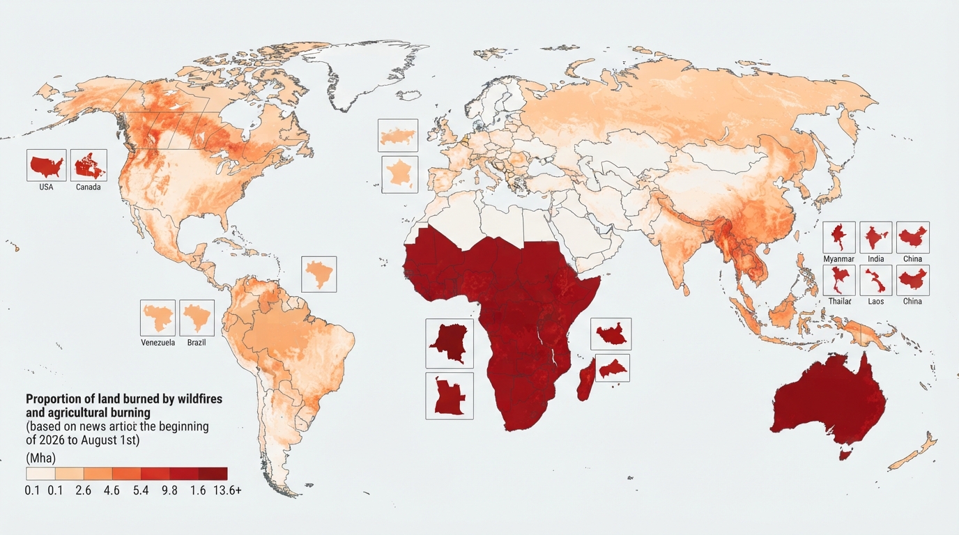
Infographic: Countries with the most burned areas in 2026
As of August 1, 2026, the area burned by forest and landscape fires worldwide reached 112.3 million hectares. The largest figure was recorded in the Democratic Republic of Congo, where 13.6 million hectares were burned.
Infographic: Countries with the most burned areas in 2026
According to an infographic based on data from the Global Wildfire Information System (GWIS), a total of 112.3 million hectares of land around the world were affected by fires from the beginning of 2026 to August 1. This is an area the size of South Africa.
This statistic includes not only uncontrolled natural fires, but also agricultural land burning and planned controlled burning.
**More than half of the fire area is in Africa**
More than half of the world's burned areas since the beginning of 2026 have been in Africa. Seasonal burning is especially common in sub-Saharan countries to clear land, manage pastures and prepare fields for planting.
Among countries, the Democratic Republic of the Congo ranks first with 13.6 million hectares of burned land. This is approximately the size of England. Next in line are Angola (7.5 million hectares), South Sudan (7 million hectares) and the Central African Republic (6 million hectares).
**Australia ranks second in the world**
The largest burned area outside Africa is recorded in Australia, which is 11.8 million hectares. With this indicator, Australia ranks second in the world after the Democratic Republic of the Congo. Also, almost all of the burned areas in Oceania are in Australia. In general, Oceania accounts for about 11 percent of the area covered by fires in the world.
**Myanmar leads in Asia**
Asia accounted for about 18 percent of the world's burned land. On the continent, Myanmar ranked first with 4.3 million hectares. India has burned 4 million hectares. In Thailand, Laos and China, the area covered by fires was 2.3 million to 2.7 million hectares in each country.
**Large fires were also observed in the USA and Canada**
In Canada, about 2 million hectares of land had burned by August 1. The fires continued in several provinces of the country. In the USA, the burned area reached 2.4 million hectares. In particular, large forest fires were observed in the states of Oregon and Washington. In early August, more than 100 large fires were simultaneously active across the country. Long-term statistics show that although the number of fires in the USA is decreasing, the total area they cover is expanding.
**In Europe, the main share fell on Russia**
Europe accounted for about 3% of the world's burned areas. Russia led the continent, with fires burning nearly 3.3 million hectares. In Spain, extreme heat and drought have burned nearly 180,000 hectares by August 1. The fire in the province of Avila is the largest in the country's history. France has also seen major fires during the same period. The total number of people evacuated due to fires in Spain and France has exceeded 300,000.
**Venezuela leads South America**
South America has accounted for nearly 7 percent of the world's burned areas. Venezuela leads the region with 3 million hectares. Brazil has also seen fires burn nearly 2 million hectares.
Experts say that the size of the area burned alone does not fully reflect the danger or intensity of the fires. Because GWIS statistics include natural fires as well as planned burning for agricultural and other purposes.