

Uzbekistan Launches ECODATA Digital Ecology Platform
Uzbekistan launched the ECODATA digital platform to unify biodiversity data and enhance nature conservation management nationwide.
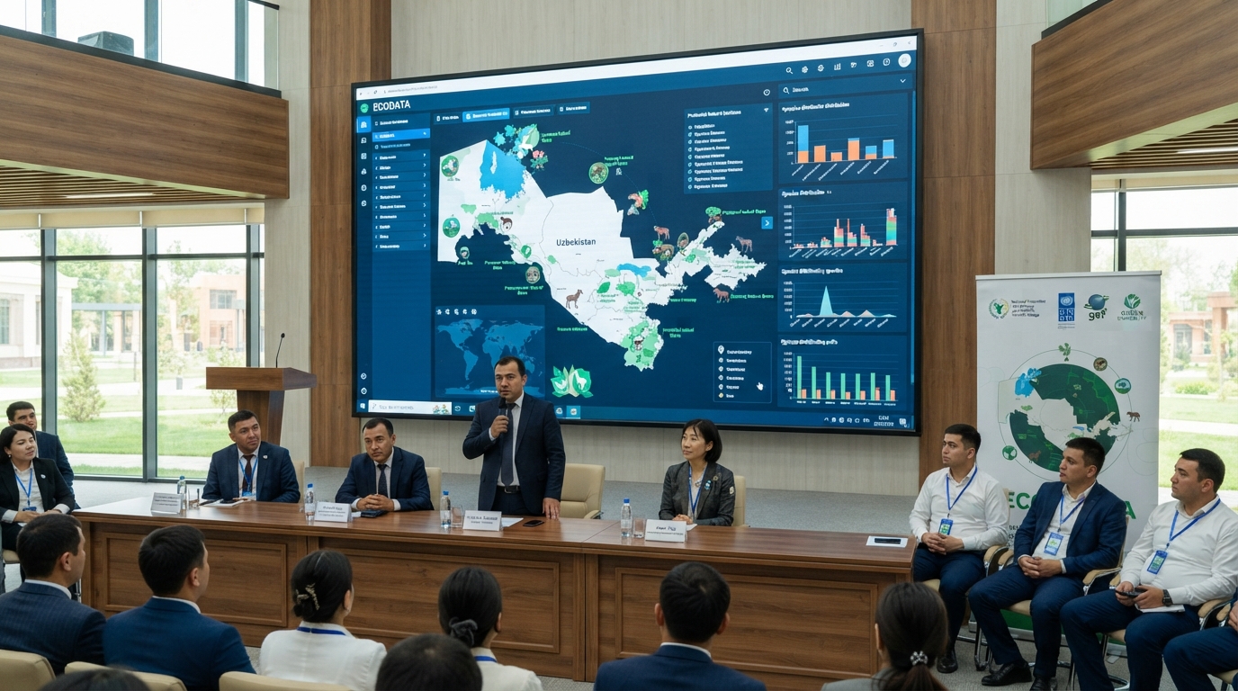
Uzbekistan has officially unveiled ECODATA, an enhanced digital geoinformation database for biodiversity and protected natural areas, in Tashkent on July 28, 2026. This platform aims to centralize environmental data into a unified digital system to facilitate natural resource monitoring, support scientific endeavors, and inform management decisions.
The launch event for ECODATA took place at Green University's Research Center for Ecology and Environment of Central Asia. Attendees included representatives from the National Committee for Ecology and Climate Change, the United Nations Development Programme (UNDP), Green University, the scientific community, various international organizations, and development partners.
Jusipbek Kazbekov, Deputy Chairman of the National Committee for Ecology and Climate Change, highlighted that digital technologies enable more precise tracking of natural resources, species distribution, and ecosystem shifts. He stated that ECODATA is designed to transform environmental data into a practical resource for government agencies, scientists, specialists, international collaborators, and the general public.
The National Committee for Ecology and Climate Change, in collaboration with the UNDP and the Global Environment Facility (GEF), developed the platform as part of the Aral Sea Wetlands project.
ECODATA integrates previously disparate information concerning flora, fauna, protected natural territories, forests, water bodies, pastures, nature management practices, and monitoring outcomes. The system currently features seven primary modules and over 60 interconnected tables, encompassing all 12 regions of Uzbekistan and the Republic of Karakalpakstan.
The system offers various user access levels at both national and regional scales, with all operations meticulously logged in a dedicated audit module.
Specific sections within ECODATA are dedicated to flora and fauna, allowing users to record species, monitor populations and distribution, document conservation statuses—including Red Data Book listings—and maintain specialized cadastres. For plant life, the system facilitates the tracking of rare species, natural pastures (including their productivity and condition), and registers of nurseries and plantations.
The platform also contains data on state nature reserves, national natural parks, wildlife sanctuaries, natural monuments, protected landscapes, forestry and hunting enterprises, fisheries, and ecotourism zones. It allows for the combination of geographical, ecological, and economic data for each territory, including details on flora, fauna, forests, and water bodies.
A key function of the system is mobile data collection directly from natural areas. Specialists will be able to log observations and cadastral data using GPS coordinates, photographs, and other relevant materials. In instances without internet connectivity, data will be stored locally on the device and automatically synchronized with the central database once a connection is re-established.
Citizens and researchers will also have the ability to submit their observations of plants and animals, attaching photographs and coordinates to their reports. Unidentified species can be forwarded to specialists for subsequent verification.
ECODATA further incorporates natural resource management tools, including a specialized quota module that will enable the calculation of limits based on species population size, distribution, and available resources.
Digital public services are also integrated into the system. Through its integration with my.gov.uz, certain procedures, such as nursery registration and confirmation of planting material, are slated for electronic transition.
Akiko Fujii, UNDP Resident Representative in Uzbekistan, noted that scientific organizations will be able to upload their research and monitoring results into ECODATA, thereby building a cumulative archive. This will enable the analysis of changes in species populations and distribution over extended periods and assist in identifying territories and species requiring additional attention.
Looking ahead, developers plan to enhance the mobile application, strengthen GIS integration, implement automated alerts for critical declines in rare species populations, develop tools to assess climate change impacts, and integrate the platform with international information systems.